Hiking in Saudi Arabia: Trails, Seasons and Where to Start
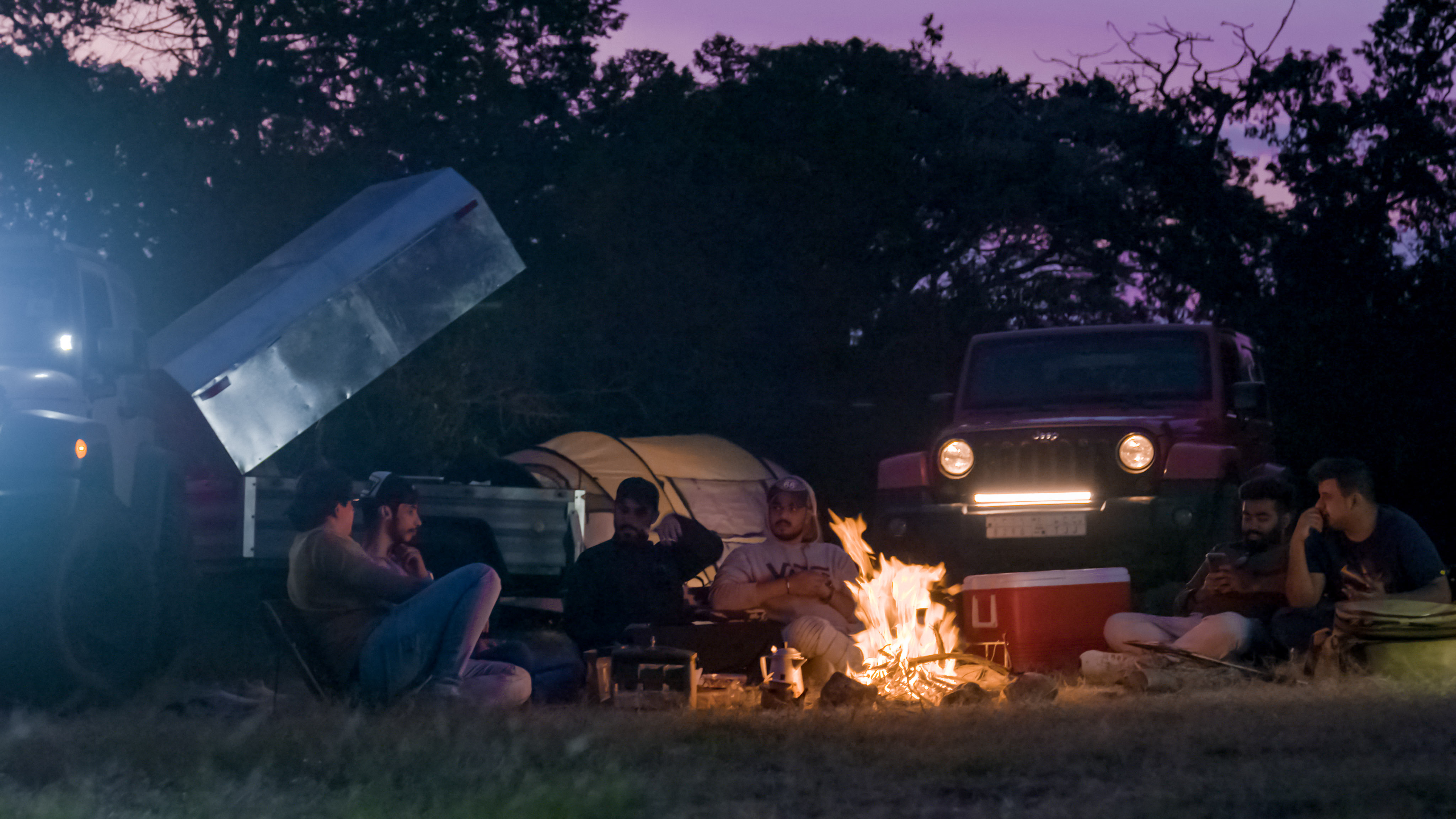
Where to hike in Saudi Arabia: the Asir highlands at 3,015 m, Wadi al-Disah in Tabuk, Sharaan in AlUla and the Tuwaiq escarpment. Seasons, access rules and practical planning.
Key Takeaways
- Saudi Arabia's high ground is the Asir escarpment in the southwest; Soudah Development states Soudah Peaks sits at 3,015 metres, the country's highest point.
- The Asir highlands are a summer destination - altitude keeps them cool while the rest of the Kingdom is too hot to walk in.
- Wadi al-Disah in Tabuk runs 125 km with year-round springs, and lies inside the Prince Mohammed bin Salman Royal Reserve, so access is set by the reserve authority.
- Sharaan Nature Reserve in AlUla covers 1,540 km2 and is walked on guided tours and defined trails, not by independent access.
- There is no national waymarking or grading system - navigate yourself with offline maps, or hire an operator with vehicle support.
- Dial 999 for police anywhere in the Kingdom. Coverage is unreliable on plateaus and in deep canyons.
Saudi Arabia is not a flat country. The southwest rises past 3,000 metres, the northwest is cut by canyon systems more than a hundred kilometres long, and large parts of both sit inside protected areas with managed access. What the Kingdom does not have is a European-style network of graded, waymarked paths. Walking here means choosing the landscape first, then sorting out access, season and navigation.
This guide covers the four regions where walking is genuinely worth the journey, the season each one works in, and the practical points that catch visitors out.
The Asir Highlands: Saudi Arabia's High Ground
The Asir escarpment in the southwest is the obvious starting point. Soudah Development, the state-owned company developing the area, states that Soudah Peaks sits 3,015 metres above sea level and is the country's highest point. Its project area covers 636.5 km² across Soudah and parts of Rijal Almaa, of which the company says only 3.6% will be built on.
The altitude changes the calendar. While most of the Kingdom is planning around winter, the highlands are at their best in summer, when cloud rolls up the escarpment from the Red Sea plain and temperatures stay far below those on the coast. That is also when Saudi families arrive, so accommodation in and around Abha books out.
Three anchors are worth knowing: the ridge walks around Jabal Sawda, the terraced cliff village of Al Habala, and the stone-and-mica houses of Rijal Almaa. Our Abha and Asir mountain guide covers the logistics of basing yourself there.
A note on the development: Soudah Peaks is a construction site as much as a destination right now. Soudah Development describes mountain trails and hiking paths among its planned offerings and states a target of over two million visitors a year by 2030, but has not published an opening date. Plan around what exists today, not around the renderings.
Wadi al-Disah: Canyon Walking in Tabuk
In the northwest, the walking is horizontal rather than vertical. Saudipedia describes Wadi al-Disah, near al-Disah village in Tabuk Province, as 125 km long with several tributary valleys, flowing from an area around 400 metres above sea level down toward the Red Sea. Springs including Ain al-Zarqa, al-Tarif and al-Namatiyah run year-round, and palm, papyrus, oleander and henna grow along the banks.
Two things matter for planning. First, the valley floor is sand and gravel between sandstone walls — the effort is in the distance and the heat, not the gradient. Second, the wadi lies inside the geographic scope of the Prince Mohammed bin Salman Royal Reserve, so access conditions are set by the reserve authority rather than by an open-access default. Check current rules before you commit to a route.
AlUla: Sharaan, and Guided Access Only
The Royal Commission for AlUla states that Sharaan Nature Reserve covers 1,540 km² and welcomes visitors through guided tours and trails, with guidelines in place to limit impact. This is the model to expect across Saudi Arabia's higher-profile reserves: the landscape is open to walkers, but through an operator and on a defined route, not by turning up at a trailhead.
The reserve protects gazelles, the reintroduced Arabian oryx and acacia woodland. For visitors, that means the walking comes with a wildlife brief attached — and with rules about where you may and may not go.
The Tuwaiq Escarpment Near Riyadh
Riyadh's own walking country is the Tuwaiq escarpment west of the city, of which the best-known section is the Edge of the World. The terrain is limestone plateau ending in an abrupt drop — the walking is short and the drive is long, and there is no fencing at the cliff line. Access arrangements at the site have changed more than once; check our destination page for the current position rather than relying on older trip reports.
When to Walk
- October to April — the working season for everywhere below about 1,500 metres: Tabuk, AlUla, the Riyadh escarpment, the Red Sea hinterland.
- June to September — the Asir highlands, where altitude does the work that winter does elsewhere. Expect cloud, mist and rain rather than heat.
- Any month — start early. Even in winter, the useful walking hours in open desert end by late morning.
Our climate and weather guide breaks the seasons down region by region.
Practical Planning
- Do not rely on signposting. Download offline maps before you leave a data signal, and share your intended route and return time with someone who is not walking with you.
- Water is the constraint, not fitness. Carry more than the walk seems to justify. There is no resupply on most routes.
- Check whether you are inside a reserve. Protected areas are managed by the National Center for Wildlife or by individual royal reserve authorities, and each sets its own access and permit rules. Our guide to Saudi Arabia's nature reserves explains which body manages what.
- Use a licensed operator for remote routes. Vehicle support matters more here than trail experience — most walking starts at the end of a track that needs a 4WD.
- Emergency numbers. Dial 999 for police anywhere in the Kingdom; 997 for ambulance. Mobile coverage is good in populated valleys and unreliable on plateaus and in deep canyons. See our safety guide for the full list.
- Dress for the country as well as the terrain. Modest, covered clothing is expected in public, including at trailheads and in villages.
Sources & Verification
Checked 21 August 2026 against the following primary sources:
- Soudah Development — About Soudah Peaks (elevation 3,015 m; project area 636.5 km²; 3.6% built area; 2 million visitors a year by 2030)
- Saudipedia — Wadi al-Disah (length 125 km; springs; location within the Prince Mohammed bin Salman Royal Reserve)
- Royal Commission for AlUla — Sharaan Nature Reserve (1,540 km²; guided tours and trails)
- National Center for Wildlife — Protected Areas (protected area list and management)
Where a figure could not be confirmed against a primary source, it is not stated here. Opening dates, entry fees and permit conditions change; confirm with the managing authority before you travel.
Frequently Asked Questions
- What is the highest mountain in Saudi Arabia?
- Soudah Development, the state-owned company developing the area, states that Soudah Peaks in the Aseer region sits 3,015 metres above sea level and is the country's highest point. It is reached from Abha, roughly a 90-minute flight southwest of Riyadh.
- When is the best time to hike in Saudi Arabia?
- It depends on altitude. Below about 1,500 metres - Tabuk, AlUla, the Riyadh escarpment - the season runs October to April. The Asir highlands work in the opposite direction: June to September is their season, because the altitude keeps them cool and cloudy while the rest of the country is too hot.
- Can you hike independently in Saudi Arabia's nature reserves?
- Often not. The Royal Commission for AlUla states that Sharaan Nature Reserve is visited through guided tours and trails. Other protected areas are managed by the National Center for Wildlife or by individual royal reserve authorities, each with its own access and permit rules. Check with the managing body before planning a route.
- How long is Wadi al-Disah?
- Saudipedia states the valley is 125 km long with several tributary valleys, flowing from an area around 400 metres above sea level toward the Red Sea. Springs including Ain al-Zarqa run year-round. It lies within the geographic scope of the Prince Mohammed bin Salman Royal Reserve.
- Are hiking trails in Saudi Arabia marked?
- Do not count on it. There is no country-wide waymarking or grading system comparable to Europe's. Download offline maps before you lose signal, share your route and expected return time with someone not walking with you, and consider a licensed operator for anything remote - most routes start at the end of a track that needs a 4WD.
- What should I carry when hiking in Saudi Arabia?
- Water is the binding constraint, not fitness: carry more than the distance suggests, because there is no resupply on most routes. Add sun protection, sturdy footwear for loose rock and gravel, and modest covered clothing, which is expected in public including at trailheads and in villages.